Lake Whatcom Comfort Stations
Bellingham, WA

VIEW MAP
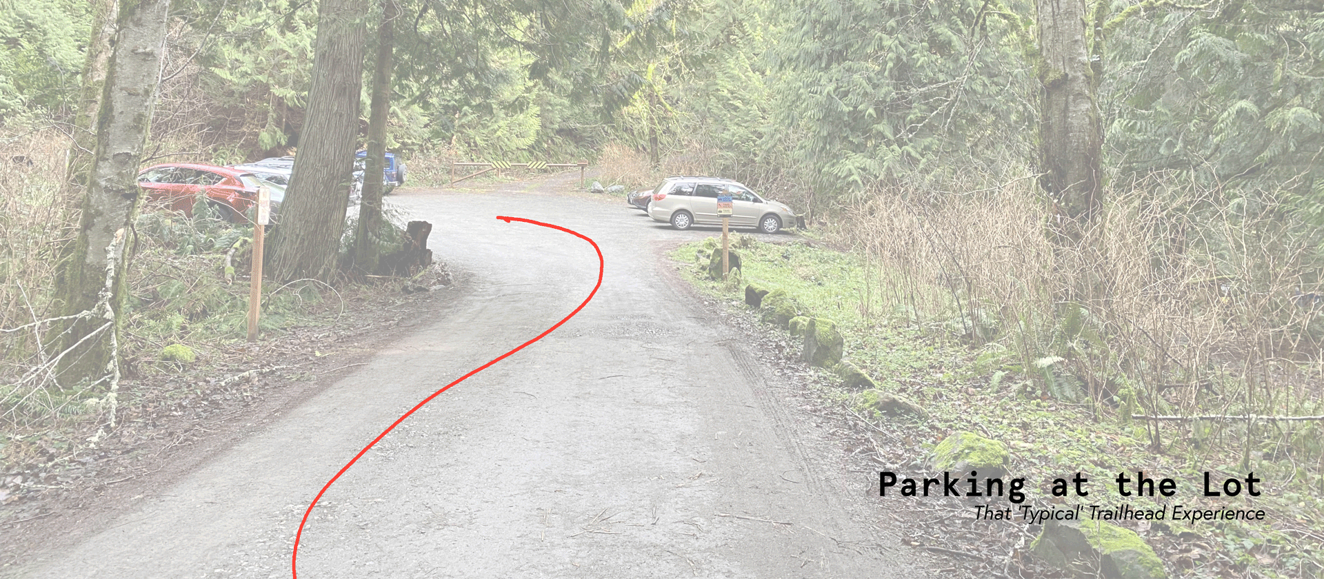
Business as Usual
Rest areas, rest stops, comfort stations — they are often the first or last place we experience when we visit somewhere new. As everyday people, we may rarely think about them. Lake Whatcom is a retreat for residents of Bellingham, and access to comfort services at the well-used trailhead of the lake that serves drinking water to 100,000 residents is essential.
Attention to detail is important with modest, active buildings such as these; these are some of the hardest-working places in the landscape, and they are used by almost everyone. They must be easy to navigate at any time and for anyone, they must be highly functional, easy to maintain, and hard to break. They must fit in; making sense for the place and the people. Perhaps a comfort station can stand out among its peers, for going the extra mile at a trailhead? That is what this project is about.
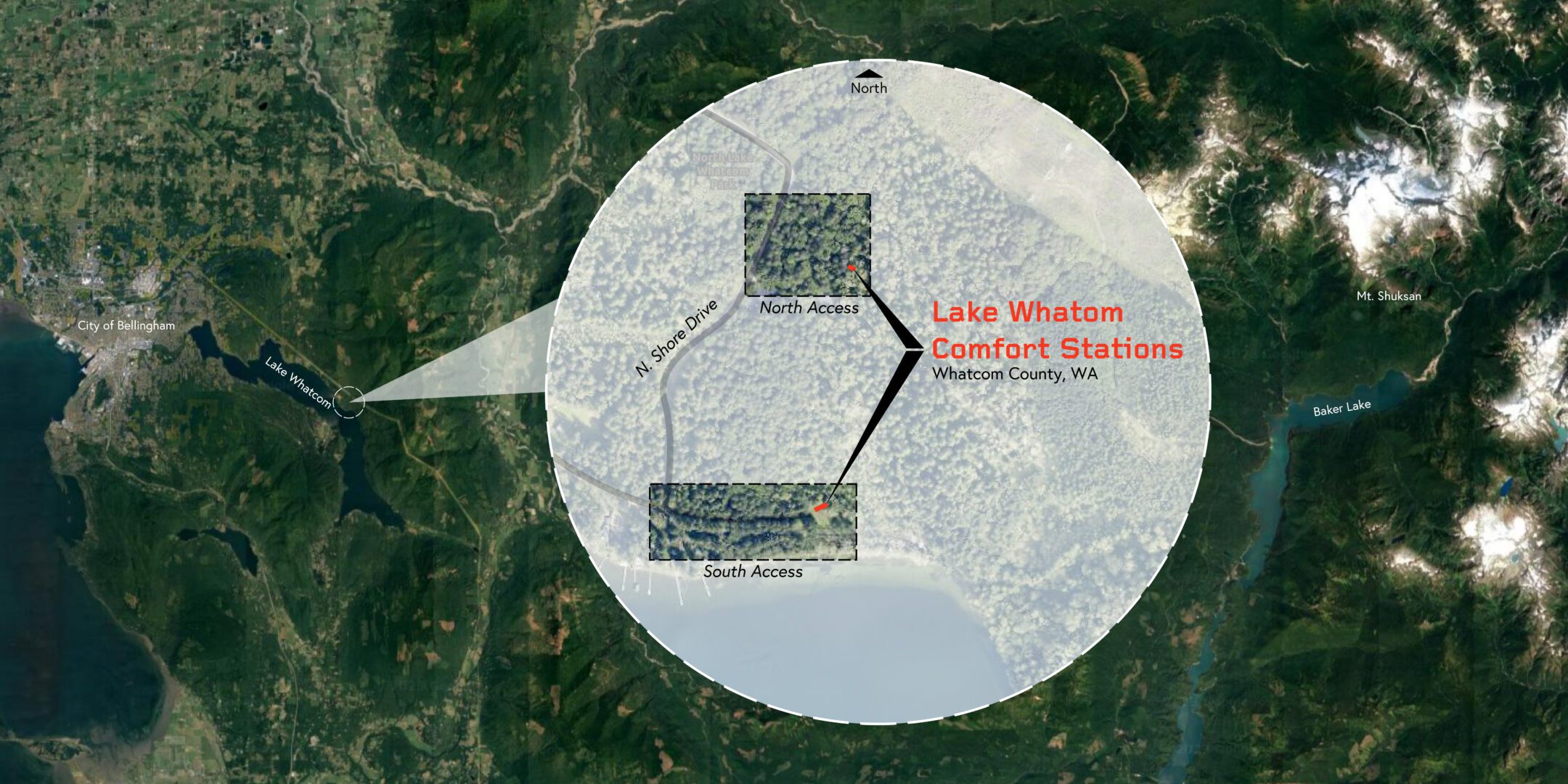
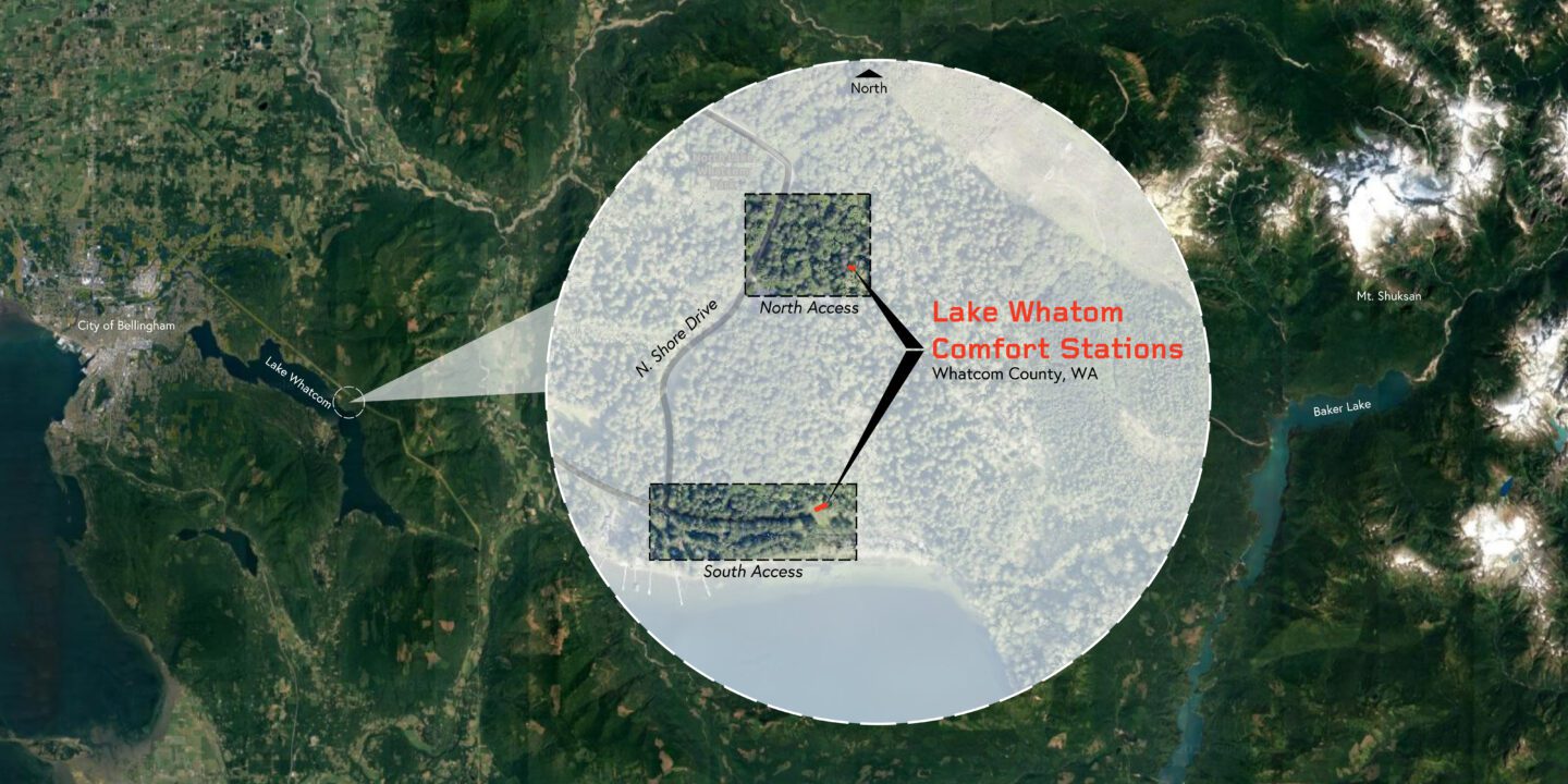
Less than 30 minutes from Bellingham, one of Washington State’s northernmost cities, sits Lake Whatcom, stretching nearly 10 miles south and covering 5,000 acres in fresh mountain water. In 2017, the local County added nearly 7,000 acres of land to the watershed—today, it totals 9,389 acres. With visitor numbers expected to double in the coming years, the County has initiated an overarching plan of improvements to ensure long-term, sustainable recreation. Our work is part of this plan.
Architecture
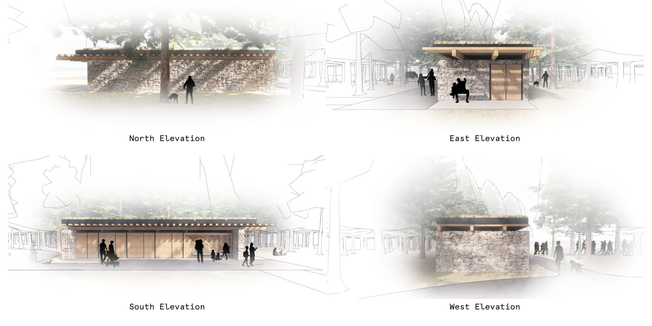
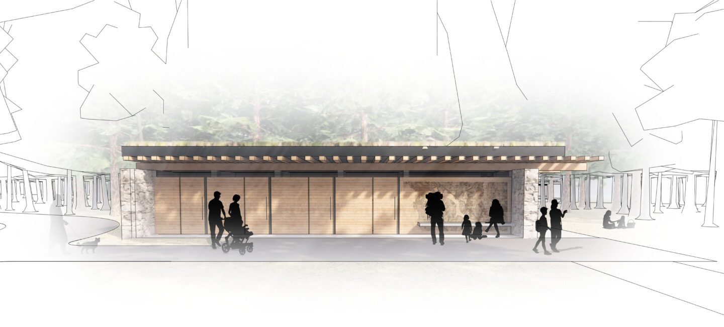
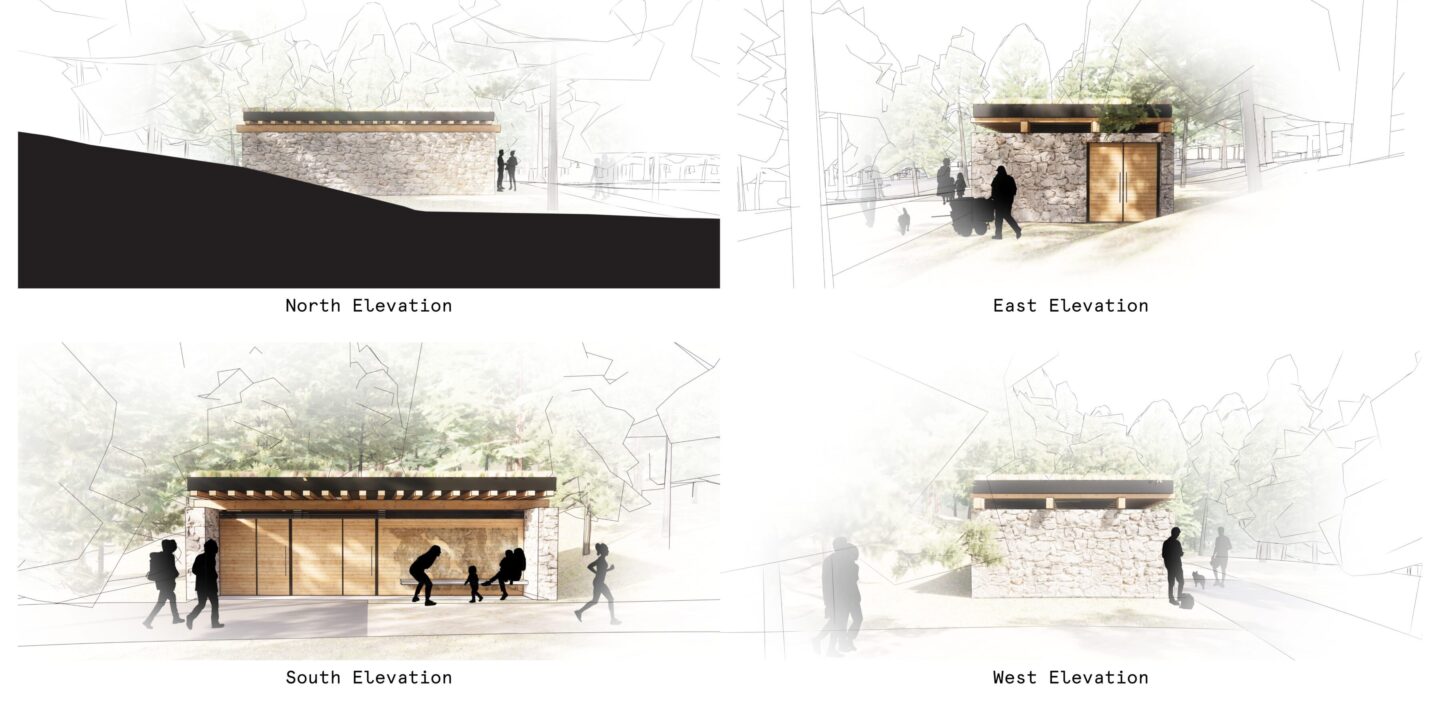
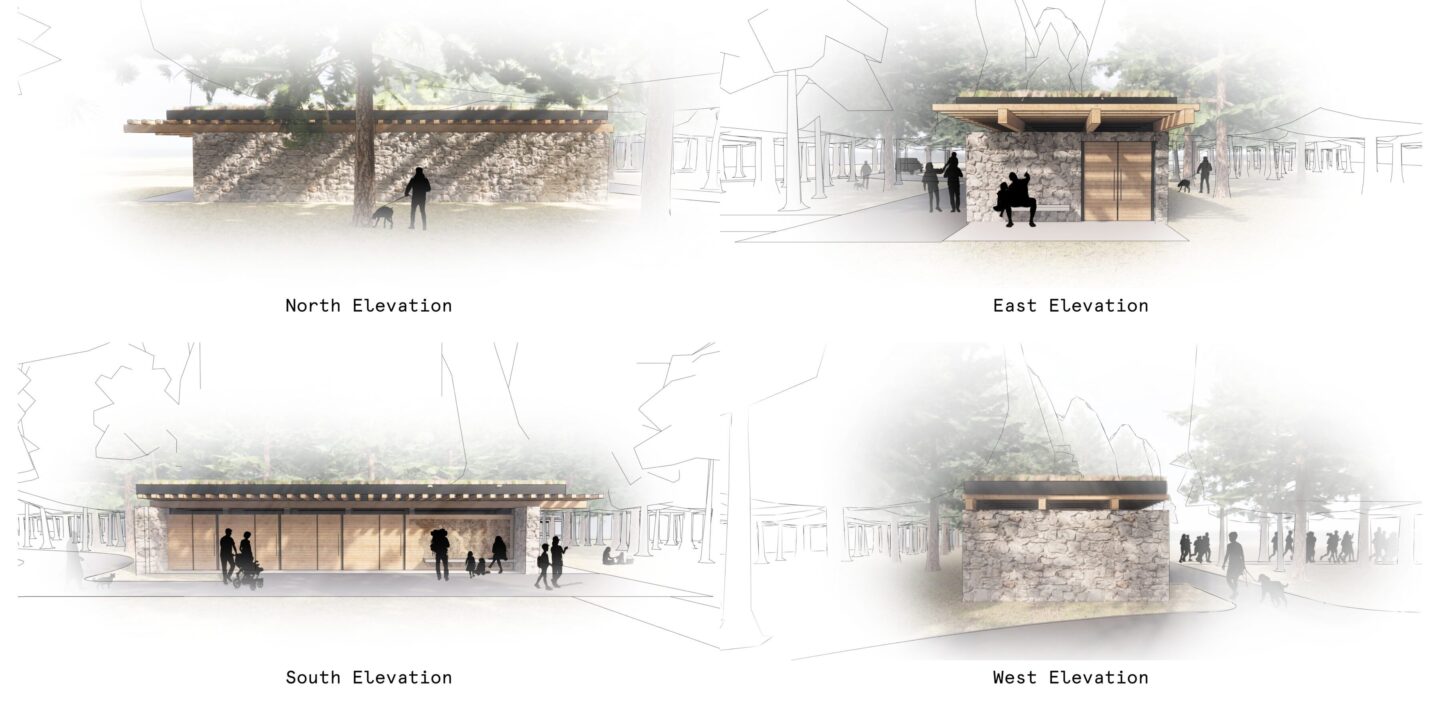
The comfort stations will sit at the existing trail entrances to the Chanterelle Trail, named for the rare and delicious local mushroom, and at the Hertz Trail, a comfortable, flat route along the river bank. The North Access Comfort Station near the Chanterelle trail includes four ADA-compliant, gender-neutral restrooms, and the South Access Comfort Station near the Hertz trail includes two ADA-compliant, gender-neutral restrooms. Upon approach, the buildings look like a boulder in the woods; wide and low, and covered with moss. The building aesthetic is composed of the materials found within its surrounding environment: heavy wood timber and stone.
The Birds Have No Idea
A green roof atop the building renders it as alive as the surrounding forest; a breathing organism changing with the seasons. Strands of light shine down into each restroom via discreet skylights hidden within the forested green roof. Each restroom has a typical array of stainless steel and vandal-proof fixtures and accessories that make the facility easy to use and easy to maintain. Both comfort stations include several semi-covered integrated benches, as well as an integrated art / trail map.
In their materiality and structural design, the comfort stations address natural disaster and environmental conservation issues typical to the Pacific Northwest climate and ecosystem, as well as those specific to Lake Whatcom, including sharp annual changes in temperature and moisture, 45-60 inches of rainfall annually, and a high degree of year-round humidity. They are helpers in the mission to protect the very sensitive environmental areas close by, such as wetlands and streams, the lake and shoreline habitats, and the general forest and animal-life ecosystems. In addition, the comfort stations are built to be resilient in the face of issues caused by people, such as fire, vandalism, and heavy annual use – while slowing roof rainfall with deeply planted roofs.
+ Research: The History of the Site
For centuries prior to European settlement, Coast Salish Tribes and the Neuk-wer tribe of Stick Samish inhabited lowland areas around the lake, fishing and hunting for game. Pictographs and a ceremonial stone bowl found here indicate that it was a ceremonial center for local tribes. A Nooksack village named Kaw-tchaa-ha-muk was established at the southern end of Lake Whatcom; it was an important fishing site and the beginning of a trail to the South Fork of the Nooksack River as well as south to the Skagit Valley.
Mining and logging began as European settlers moved to the area in the mid 1800’s. By the late 1800’s, the Blue Canyon Mine, logging camps, lumber mills, and several small towns were located along the shoreline. By the early 1900’s, low elevation timber was exhausted and nearly all old-growth timber was removed from the watershed by 1918. As forests matured, significant pieces of second growth timber were removed in the 1980’s. Public pressure following a large-scale debris torrent in the Smith Creek drainage in 1983 resulted in DNR acquiring all of the lands in the project area.
Team
- Owner: City of Bellingham
- Architect: Signal Architecture + Research
- Landscape Architect and Master Planner: MacLeod Reckord
- Surveyor: Wilson Engineering
- Geotechnical: Geoengineers
- Civil Engineering: Pace Engineers
- Structural Engineer: Lund Opsahl
- Environmental Engineer: Canyon Environmental Group, LLC
- Electrical Engineer: K Engineers
- Arborist: Urban Forestry Services
- Archaeologist: Willamette Cultural Resource Associates
Estimated No. of Visitors Per Year (2015): 54,888
Annual Revenue Spent on Outdoor Recreation in Whatcom County: $585 Million
Acres of Recreation Supported by the Project: 4,800